
Social distancing of 6 feet or more during the coronavirus pandemic is even more difficult this spring and summer because record-high Great Lakes water levels have eaten away beaches where we otherwise could walk at our leisure.

Social distancing of 6 feet or more during the coronavirus pandemic is even more difficult this spring and summer because record-high Great Lakes water levels have eaten away beaches where we otherwise could walk at our leisure.

On Friday, Jan. 17, at 1:30 pm, Mark Breederland, Extension Educator for Michigan Sea Grant’s Northwest District, will give a talk about current and projected water levels in the Great Lakes at Leland Township Library. Breederland gave a similar talk in Peninsula Township in November of 2019, which drew an audience of over 100 people.

Higher Lake Michigan levels have shrunk beach areas and are exacerbating the struggle between public beachgoers and private landowners over access to our shoreline. A prime example can be found at the 60-foot-wide beach access at Reynolds Street in Leland, which for decades has been called “South Beach”.

Pack away those dreams of walking miles from bay to bay along the shores of Lake Michigan this summer—unless you want to get wet, that is.
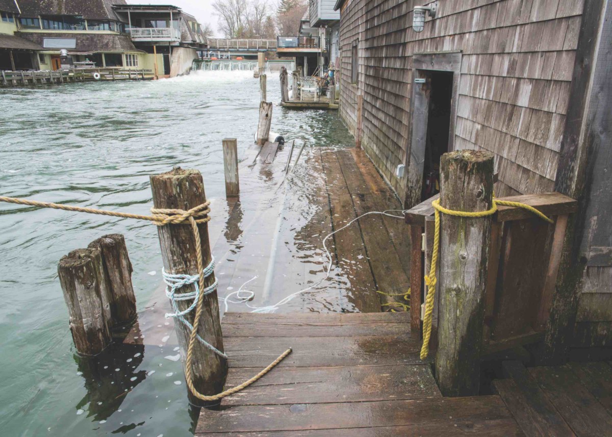
On Thursday, May 9, a series of seiches impacted Fishtown, dramatically raising the Leland River. Seiches are common but the higher water levels this year make the docks and shanties more likely to flood.

With Lake Michigan as high as it is right now, 579.6 feet, that means less than one foot of elevation from the water’s edge would require a DEQ permit if a beach owner wanted to “move around” the sand or remove vegetation.